★ Save on shop price when you subscribe. Pay just £2.80 per issue – 43% cheaper than buying in-store at £4.95! ★


DJI Matrice 4T review: the thermal drone transforming deer management
Jules Whicker spent a winter flying DJI's Matrice 4T Enterprise, a thermal-equipped survey drone, across his deer ground from November to April. His verdict: an expensive but genuinely transformative tool for counting, assessing and recovering deer, day or night


There is an old saying that “time spent in reconnaissance is never wasted”. True enough, though it is all too often paired with a quip about an “armed nature ramble” as we console ourselves for a blank outing. But what if you could massively increase the speed, coverage and accuracy of that reconnaissance? What if you could locate, identify, even age and sex every deer on a hectare of ground in under ten minutes, or rapidly find a wounded animal without the risk of bumping it on?
You can see the direction this is taking, and it will raise some hackles, not to mention some valid concerns about “fair chase”. If, however, you think that managing deer based on the efficient acquisition of accurate population and distribution data is preferable to a system based on partial observation and rough rule of thumb, this review of DJI’s Matrice 4T Enterprise should be the most validating thing you read today. I was fortunate to secure the use of a Matrice 4T from November 2025 to April 2026 – months when vegetation is sparse, trees offer little cover from above and ambient temperatures are typically well below the body temperature of deer.

Specification
| Specification | Detail |
|---|---|
| Price (RRP, complete kit) | £5,910 |
| Thermal camera | 640×512, 12μm (detects deer up to 1,500m in the open) |
| Zoom camera | 48MP, hybrid zoom up to 112x |
| Wide-angle camera | 48MP |
| Laser rangefinder | 1,800m |
| Night vision | NV camera and infrared illuminator (range around 100m) |
| Obstacle avoidance | Six collision-avoidance cameras |
| Flight time | 30 to 45 minutes per battery |
| Spare battery | £160 each (DJI only) |
| Controller | DJI RC 2 Plus (Android) |
| Also included | Four-station charging dock, Flight Hub 2 access, one year’s DJI Care Enterprise cover |
| UK supplier | Scott Country |
Prices are RRP at the time of publication and may have changed since.
First impressions and the camera array
The M4T’s foremost imaging tool is its 640×512, 12μm thermal camera. It will detect deer in the open as much as 1,500m away, and find them in deep cover with a single overhead pass. Complementing the thermal is a 48MP daylight camera with a hybrid zoom of up to 112x. Depending on atmospheric conditions and the location and species of the deer, it is usually able to identify and assess an animal from a distance of 200m to 400m.
Harnessing this powerful zoom is made easy by a green frame that indicates the field of view within the thermal image, so the target is already centred in the display when you switch to 4K. Alternatively, you can activate a split-screen mode, viewing the thermal and zoomed images simultaneously. The third principal camera is a wide-angle 48MP unit, which provides rapid orientation and is my default mode when flying to an observation point. It also lets you take highly informative aerial images, perfect for creating an overflight video of your ground to share when orientating guest stalkers.

The sensor array also includes an 1,800m laser rangefinder for survey work, and a night-vision camera with infrared illuminator for detailed observation at night. With a limited range of around 100m, the NV system is better suited to security tasks than to monitoring deer, but it is still a useful function to have. Optional spotlight and loudspeaker modules are available for security applications. The four principal cameras are mounted in a gimbal suspended from the drone’s nose, and an additional six collision-avoidance cameras are installed in the body, preventing you from flying into obstacles, first via an audible warning and then by halting the drone a safe distance from the hazard.
How the Matrice 4T performs in the field
The M4T has transformed my deer management practices. This winter it showed me exactly how many roe does were on each patch, letting me judge not just how many I should take but also which individuals, and keeping me from overshooting. It accelerated my learning of deer habits on new permissions and let me plan rapid stalks to animals I wanted to take when time was tight.

Best of all, when a bodged shot allowed a wounded deer to get up and disappear into an acre of chest-high covercrops, the drone enabled me to locate the animal quickly, drop a pin on the map, screenshot it to my phone and make a precise follow-up and despatch. The split-screen function is central to this kind of work, letting you centre the target in the zoom camera’s window for detailed identification of the species.

Flying the drone
I was initially anxious about my piloting skills, but the basics are quickly mastered and each flight develops your competence and confidence. The M4T is also very good at looking after itself: you can program routes, fly the drone automatically and simply press pause to regain manual control. Press home at any point and it returns and lands itself precisely at its starting point, which also happens automatically when the battery reaches 25%.
Flight time depends on whether you are covering ground or hovering, plus temperature and wind, but expect 30 to 45 minutes from a full charge. The four-station charging dock runs from the mains or a fast car charger and takes a battery from 25% to 90% in around 40 minutes. Batteries are exclusive to DJI and cost £160 each; two is a practical minimum and four would be ideal. The M4T has three flight modes: Sport (most agile, up to 70km/h, at the expense of obstacle avoidance), Function or Tripod mode (maximum stability and fine control for framing a target) and Normal mode for systematic sweeps of forestry blocks.
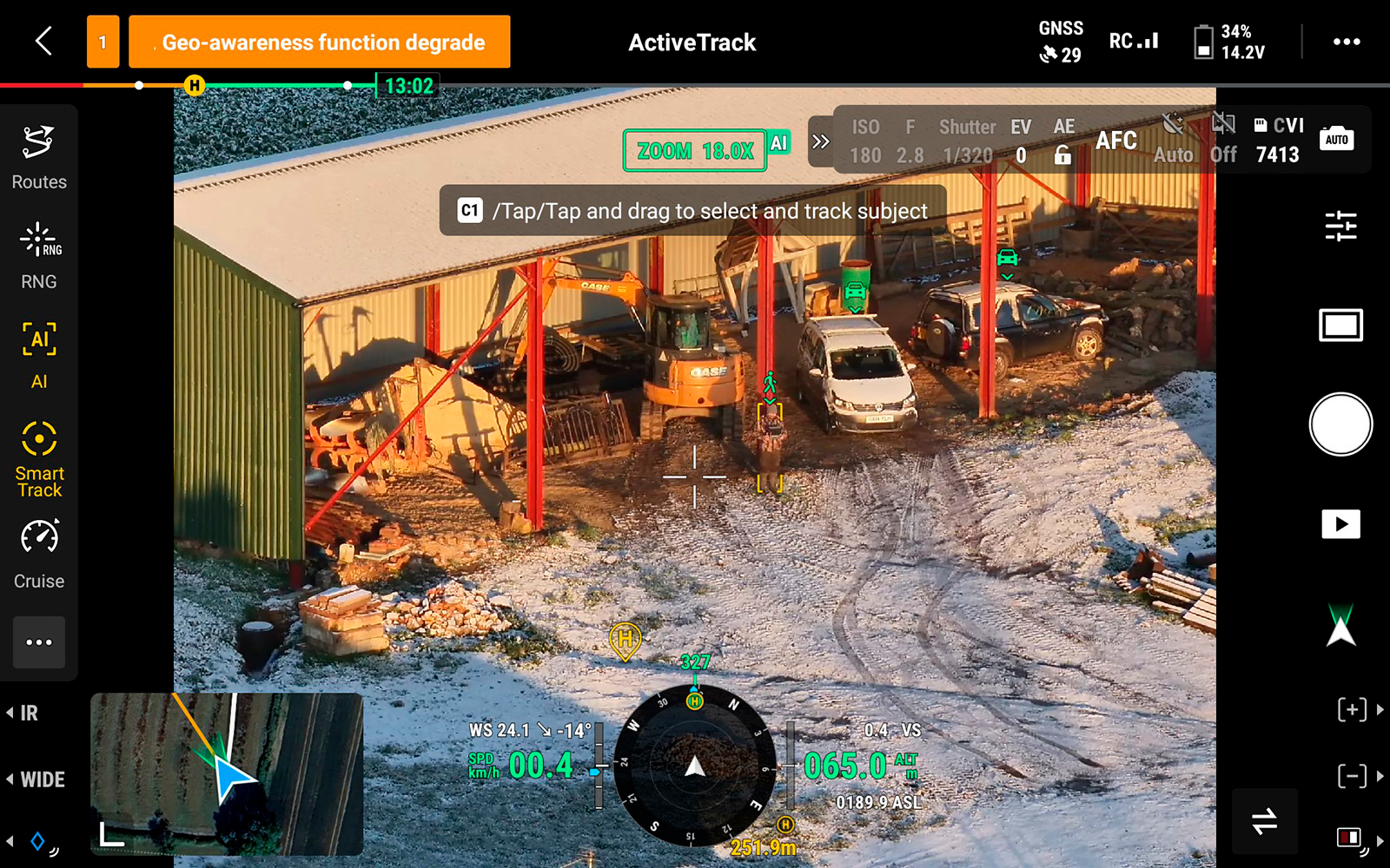
The M4T is supplied with DJI’s RC 2 Plus controller, which runs on Android and can be loaded with apps to map airspace restrictions (dronemap.uk), monitor the weather and share images with colleagues. The DJI Pilot 2 flight interface looks dauntingly information-heavy at first but soon gives fast access to every capability, and the controller doubles as a planning platform, syncing to Google Maps to set up routes. The manual is installed on the controller too, making it easy to learn as you gain confidence.

Views, ethics and the law
While there is clearly scope for unethical use, the benefits are many and undeniable. Aerial reconnaissance and targeted stalks reduce overall disturbance, a pre-stalk recce will alert you to livestock, agricultural work or trespassers that would otherwise scupper your plans, and overflying grass fields before mowing is a simple way to reduce fawn mortality.

On the legal side, leisure users need to complete a free Flyer ID test and pay £11.79 a year for an Operator ID. Commercial users may need further qualifications – the A2 Certificate of Competency and the General Visual Line of Sight Certificate – depending on where and how they operate, along with a CAA Operational Authorisation and public liability insurance. Legal flight restrictions include a maximum ceiling of 120m and operation within line of sight, often cited as under 500m. It helps that the M4T has running lights and a beacon, but I would recommend adding fluorescent and reflective strips to help it stand out against the sky.

Strengths
- Exceptional thermal detection, picking up deer to 1,500m in the open and finding them in deep cover with a single overhead pass
- Powerful 112x hybrid zoom and a split-screen thermal/daylight view for confident species and sex identification
- Genuinely transformative for deer management: accurate counts, targeted stalks and rapid recovery of wounded animals
- Easy to fly, with strong automation, six-camera obstacle avoidance and precise self-landing
- Comprehensive kit and support, including the charging dock, Flight Hub 2 access and a year of DJI Care Enterprise cover
Weaknesses
- A substantial outlay at £5,910 for the complete kit, plus £160 for each spare battery
- Flight time of 30 to 45 minutes makes spare batteries all but essential
- Night-vision range is limited to around 100m, so it suits security more than night deer work
- Leisure and, especially, commercial use carry real licensing and insurance requirements
- Raises genuine “fair chase” and ethical questions the operator has to weigh for themselves
Verdict
The M4T undeniably represents a substantial outlay, but it has been such a transformative tool for my deer management that I am seriously thinking about finding the funds to acquire my own. If you manage deer at any scale and want accurate counts, efficient culling decisions and the ability to recover wounded animals quickly, it is hard to overstate the difference it makes. It is not a toy, the cost and the legal obligations are real, and the ethical questions deserve honest thought, but as a survey and management tool for the committed deer manager it is in a class of its own. The Matrice 4T is available from Scott Country at scottcountry.co.uk.
Frequently Asked Questions
How much does the DJI Matrice 4T cost?
The complete kit – drone, controller, batteries, charging dock, cables and Peli-case – came in at £5,910 at the time of testing. Spare batteries are exclusive to DJI and cost £160 each, and a practical minimum is two. Prices are RRP and may have changed.
What can the Matrice 4T’s thermal camera detect?
Its 640×512, 12μm thermal camera will detect deer in the open at up to 1,500m and find animals in deep cover with a single overhead pass. The 48MP zoom camera, with up to 112x hybrid zoom, will then usually identify and assess an animal from 200m to 400m depending on conditions.
Do you need a licence to fly a drone like this for deer management?
Leisure users must complete a free Flyer ID test and pay £11.79 a year for an Operator ID. Commercial users may also need the A2 Certificate of Competency and the General Visual Line of Sight Certificate, plus a CAA Operational Authorisation and public liability insurance. A 120m height ceiling and line-of-sight operation apply.
Where can I buy the DJI Matrice 4T in the UK?
The review unit was supplied by Scott Country, which stocks the Matrice 4T Enterprise. See scottcountry.co.uk for current pricing and availability.
Related Articles
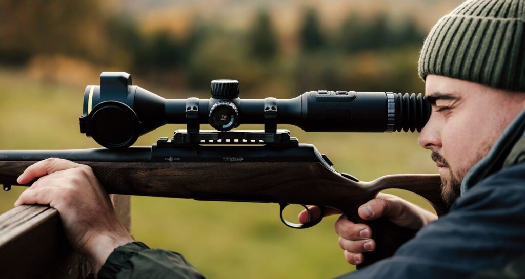
When the heat is on: the rise of the affordable thermal riflescope
Once a luxury for the professional pest controller, thermal riflescopes have tumbled in price and soared in capability. Selena Barr talks to the trade about sensors, rangefinders, the law and where th...
By Selena Barr
ZEISS Secacam Trail Cameras: the essential tool for modern deer management
Professional deer stalker Jim Riley explains how ZEISS Secacam trail cameras have transformed deer management, wildlife monitoring and estate security at Chippenham Park Estate, helping deliver more e...
By Shooting Times
Get the latest news delivered direct to your door
Subscribe to Shooting Times & Country
Discover the ultimate companion for fieldsports enthusiasts with Shooting Times & Country Magazine, the UK’s leading weekly publication that has been at the forefront of shooting culture since 1882. Subscribers gain access to expert tips, comprehensive gear reviews, seasonal advice and a vibrant community of like-minded shooters.
Save on shop price when you subscribe with weekly issues featuring in-depth articles on gundog training, exclusive member offers and access to the digital back issue library. A Shooting Times & Country subscription is more than a magazine, don’t just read about the countryside; immerse yourself in its most authoritative and engaging publication.